Tropical Storm Warning Issued for Northern Bahamas, Same Area Devastated by Dorian
Read Transcript
- Joining us now is Chief Meteorologist,
with weatherbell.com,my man, Joe Bastardi.
Joe, great to have you back on.
So, tell us about this approaching storm.
What's expected to happen here?
- Well, good news for theBahamas, I don't think
it's that big a deal asfar as those places go,
even though the centermay go very close to them.
It's weak, most of the heavy precipitation
and higher winds willbe off to the northeast,
more of a nuisance situationto cleanup operations.
Now, when it gets north of the Bahamas
I think it is gonna become a hurricane
and far to the east of the Florida coast,
a lotta company is muchfurther east of the track,
at least in relation to Florida.
However, during nextweek it may get blocked
from going completely out to sea
off the south Atlantic coast.
If that's to be the case,then as the week wears on
we may have a slowmoving hurricane sitting
off the southeast coasttrying to make up its mind
whether it wants to come back
toward the United States or not.
But, the good news for the Bahamas is,
the bulk of the worst weatheris gonna miss the Bahamas.
I won't say that it'sgonna be perfect weather.
They're gonna get some squallsand some thunder storms,
some heavy rains, maybe acouple of inches of rain
at Abaco and perhaps Grand Bahama
and wind gusts of 30, 40 miles an hour,
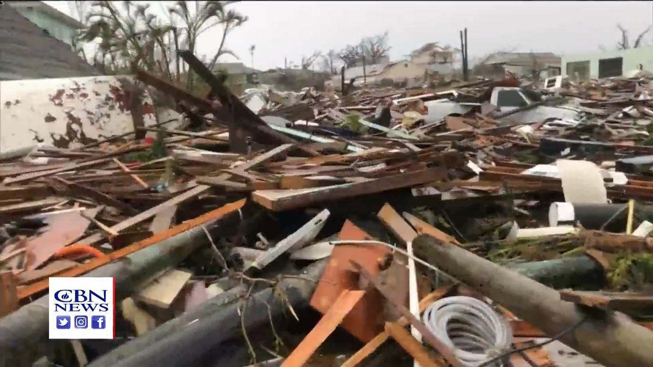
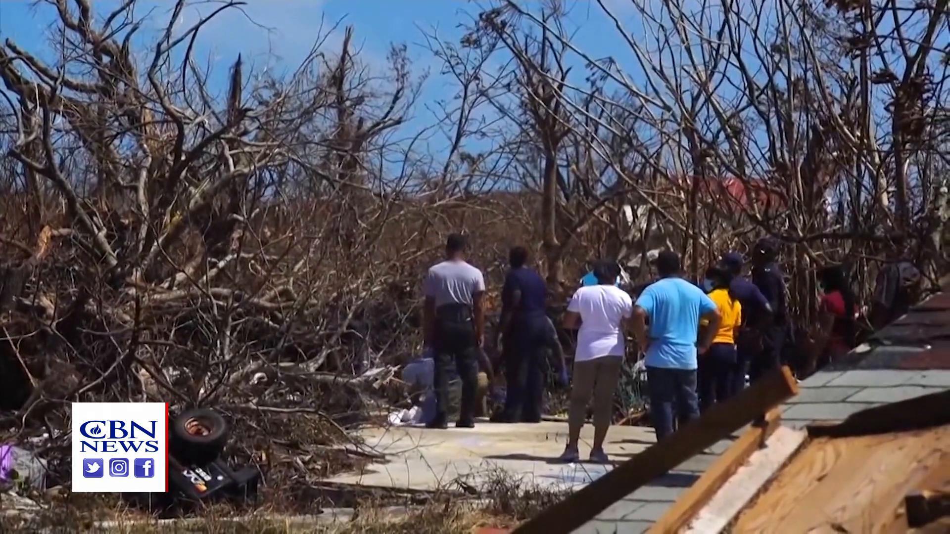
but far short of whatcould happen and of course,
what did happen with Dorian.
- Do you expect this particularsystem to make landfall
in the United States?
- Well, I did yesterday.
Right now, the models areall out to sea with it.
The problem I have is I'veseen patterns like this,
Jeanne in 2004, Betsy 1965, for instance,
where storms that looked like they were
gonna head out to sea got blocked
by a big high pressuresystem and as the same
high pressure system that cansqueeze it and send it out,
with the upper air pattern the way it is,
can get out in front of it and block it,
so it starts going out and turns around
and starts coming back.
And, it's also in that area notorious
for slow moving, erratic storms.
If you go back and lookat hurricane tracks
over the years, that areaoff the south Atlantic coast
in September, even October, storms love
to dance around there.
So, it may be next week at this time,
this is still on the charts.
And the other problem isthat the overall pattern's
going to get active again, quite active.
I mean, I'm worried we seesomething try to develop
in the western Gulf ofMexico Monday or Tuesday,
just before making landfall in Texas.
Tropical wave in theAtlantic looks like it's
gonna try to develop whenit gets into the area
that Dorian was in and this one was in.
So, I think the pattern's gonna be active
the rest of the way in andI guess I'd be surprised
if there weren't a couple more storms
that threaten, that did notthreaten the United States.
I'd be more surprised if therewasn't than if there was.
- Let's talk about that.
There are other storm systems dancing
in the Atlantic right now.
Any of them of concern to you, sir?
- The system in the fareastern Atlantic is not
a concern until it gets towhere these storms are going.
The pre-season forecastthat we put on showed
that storms were not gonna be that strong
around the islands and they're not.
It's when they get north,by the islands I mean,
Hispaniola, Puerto Rico.
Even though you say,well, Dorian was strong
near Puerto Rico, not nearly as strong
as what it was up in the Bahamas.
So, the problem we havethis year is that in close
to the United States,within 300, 400 miles,
is where storms are favored to intensify.
So, you could get some tropical wave
that doesn't look likeanything for eight, 10 days,
but it starts getting incloser to the United States,
gets into the Gulf or the southeast coast
or in the Bahamas, like this one.
This one just didn't appear.
It's been out there trackingacross the Atlantic.
They get in closer andthen they try to develop.
So, that's unique tothis particular season,
but of course, when they develop in close
you have to really reallytake a look at 'em.
Back in 2017, or evenFlorence, that guy developed
way, way away from the United States
and we could see itcoming 10, 15 days away.
So, that's the problem withthe rest of the season,
forecast headache forthe rest of the season.
- Okay, terrific, Joe, as always, sir,
thank you so much and havea fantastic weekend, man.
- Okay, you too.
Thanks for having me on.